Quick Help
Click below to find help with the different options from the MapLink homepage.
You can find your community’s MapLink site at our Library page.

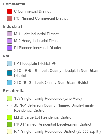
Interactive Zoning Map

District Layer / Parcel Layer Toggle


Note: Enabling the parcel layer when zoomed out may impact performance. It is recommended that you zoom in slightly before turning parcels on.

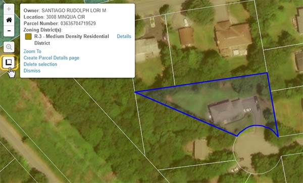
Parcel Details Page
- Unique page for each parcel (can be easily shared)
- Contains all relevant information about the parcel including:
- Applicable overlay district(s) information
- Base zoning district(s) information
- District description
- Dimensional standards
- Allowable land uses including development requirements and applicable procedures.

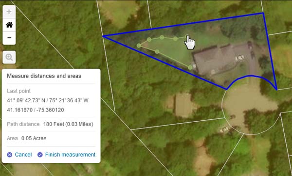
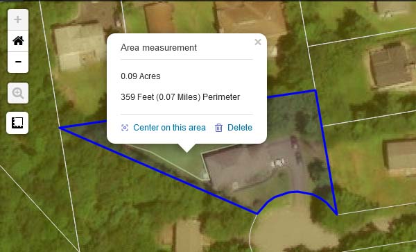
Measurement Tool
Estimate distances and areas on the map.
To Measure Area:
- Zoom to the area to be measured
- Click the Measurement tool
- Click in one corner to start the measurement
- Continue clicking the corners around the area in the same direction (i.e. clockwise). For round areas you will need to click more often to make an arc.
NOTE: You do not need to “close the loop” by clicking back at the start – the area will automatically close itself. - Click Finish measurement to get the final result.
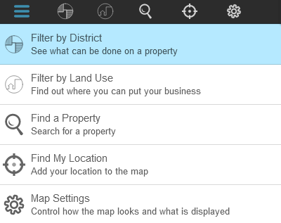
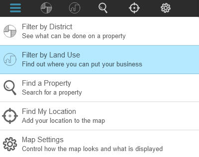
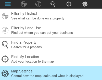
Filter by District
Explore the base zoning districts details. Review allowable land uses for that district.
1
Click Filter By District in the left-hand menu.
2
Select a zoning district. The map will update to display only the selected district.
3
Expand the details to see what standards apply and which land uses are allowed.

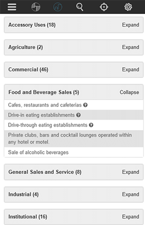
Filter by Land Use
Explore the map by Land Use to determine where businesses or projects are permitted.
1
Click Filter By Land Use in the left-hand menu.
2
Select a Land Use and the map will update to display only districts where that Land Use is permitted.
3
The map will update to display only districts where the chosen Land Use is permitted. It will then update further to display only the selected district.

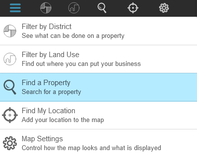
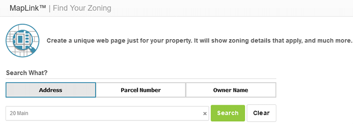
Find a Property
Identify a specific parcel on the map.
1
Click Find a Property in the left-hand menu.
2
Search by Parcel Number, Address, or Owner Name (optional)
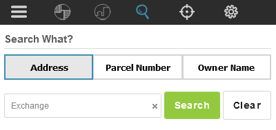
3
Select the desired property in the left hand panel to zoom to the parcel on the map and open the parcel details box for that parcel.

Map Settings & Overlay Districts
Change which Overlay Districts display and modify the map appearance.
1
2

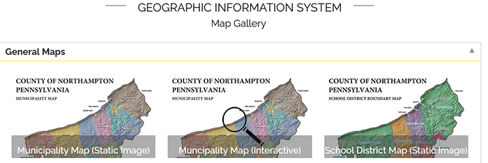
More Maps
When mapping content is available from external sites, it may be provided here.
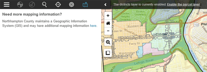
Click the link to be redirected to a site with additional information.
Highlights
Use Highlights to view zoning information by category without having to navigate the map or the code book.

Dimensional Standards
View summarized dimensional standards by zone district.
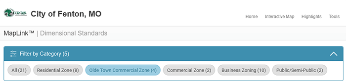
Select a zone type to filter by category.

View the dimensional standards for zones in that category; complete with links to the Code.
Procedures (optional)
Additional information necessary for proceeding with a project.
- Different procedures may be organized into groups.
- Select the appropriate procedure from the list to expand the entry.
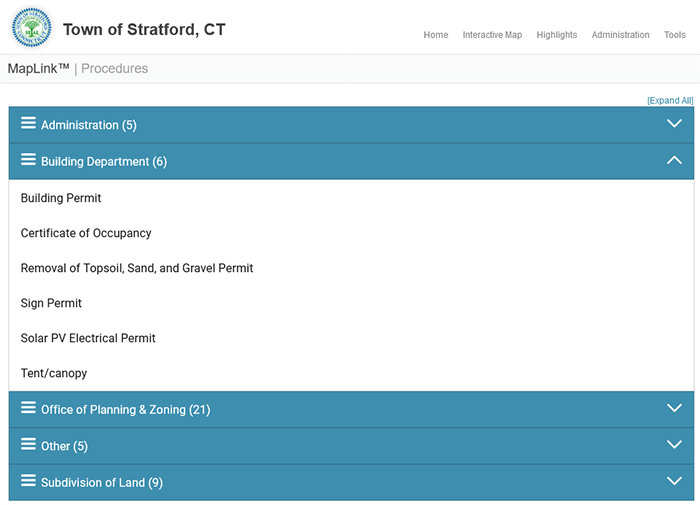
- Procedures may include filing instructions, links or other related documents to complete the application process.

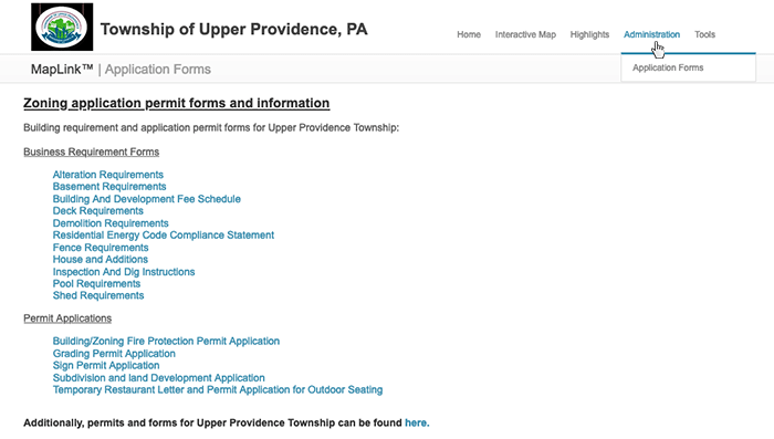
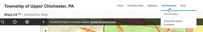
Permits, Forms and Applications (optional)
Provide users with the links to important permits, forms, and applications.
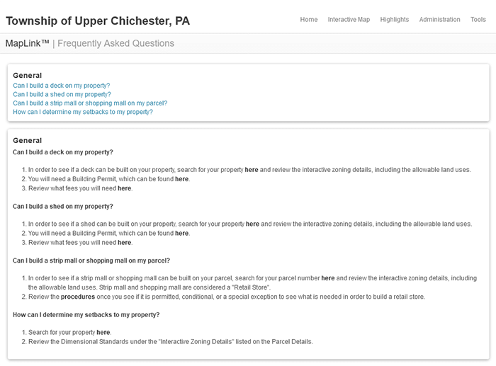
Frequently Asked Questions (optional)
A Frequently Asked Questions page may be set up to help users navigate the site and/or reduce the numbers of calls about common questions.
Find My Zoning
Shortcut to jump to the information about an individual parcel without having to access the map.
Will open the individual Parcel Details Page.